We deployed Orca 1.4.1 early to a handful of evidence review teams. Property-search is the newest Orca feature. It is still in research mode.
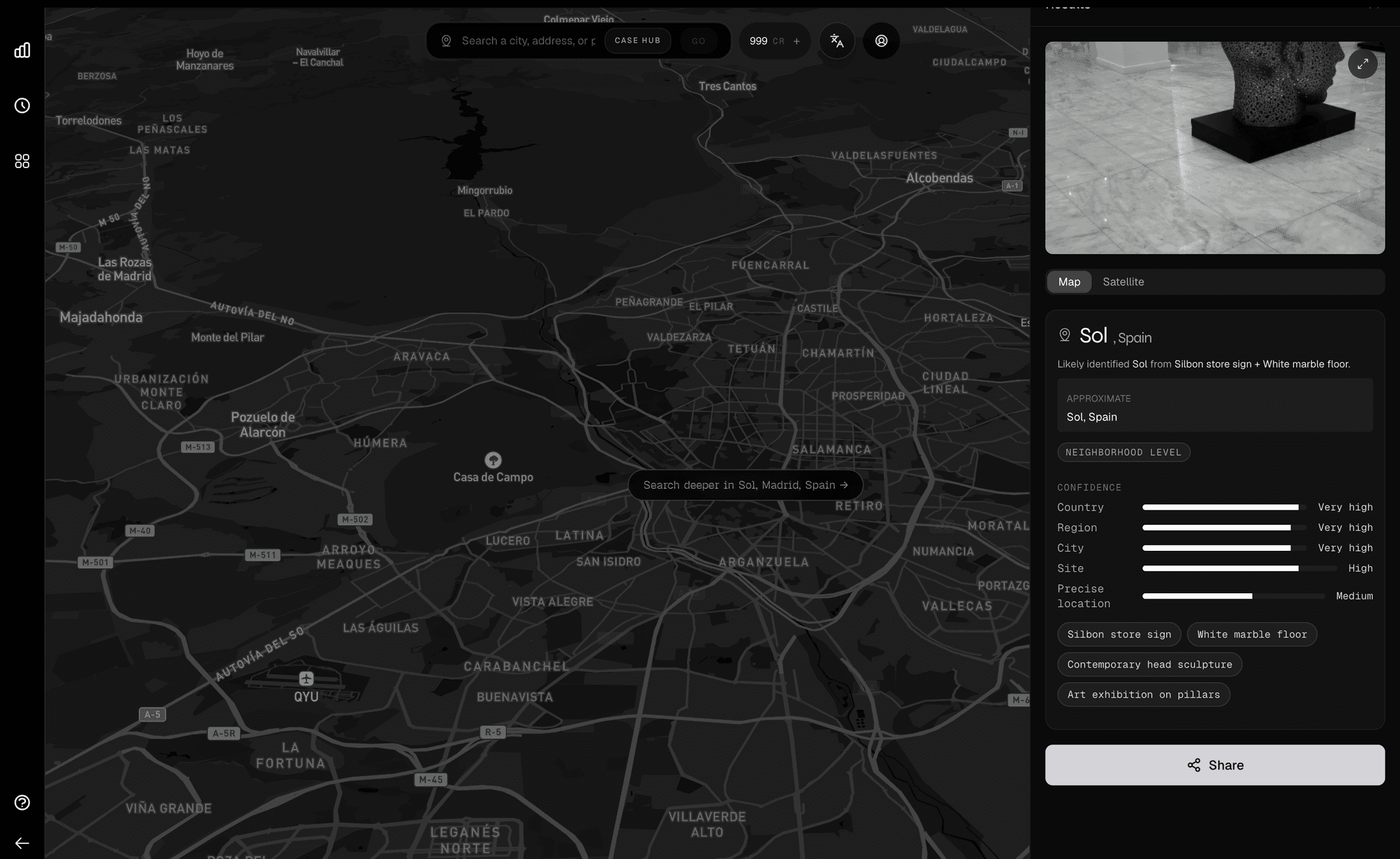
This run started from a small field set of images with no reliable GPS metadata. The unit did not need a perfect story. They needed to lock the target area fast, then work a shortlist they could verify on the ground.
We tested this in Miami-Dade. The unit asked to stay anonymous, so names, addresses, and identifying details are intentionally left out.
Case setup
- Deployment mode: Orca 1.4.1 early access with review teams.
- Feature status: Property-search is active but still in research mode.
- Input: a small batch of field images with stripped or unreliable metadata.
- Operational target: get useful leads in under two minutes.
- Decision standard: reduce the field enough for fast human verification.
- Publication rule: no names, addresses, or personal identifiers.
Workflow timeline (52 seconds)
Latency Curve
From manual triage to sub-minute shortlist
Time reduction
89%
Property-search contraction
Property-search starts at 30 seconds and progressively gets smaller as filters stack. The result is a faster handoff to human verification.
00:30
18 candidates
Initial property-search pass in local zone
00:24
11 candidates
Parcel frontage match removes weak options
00:18
7 candidates
Boundary and access-road checks tighten the list
00:12
4 candidates
Human-review shortlist is ready
Measured outcomes
Average triage time
8m -> 52s
Measured over repeated runs of the same workflow template.
Candidate set size
37 -> 4
Large open search collapsed to a workable short list for review.
First useful lead
< 1 minute
Team reached decision-ready output while context was still fresh.
What changed in practice
Before this workflow, analysts were jumping between map tools, satellite tabs, and property records with no clear ordering logic. That meant long cycles and low confidence when time was tight.
With Orca 1.4.1 and the property-search preview, they start with a ranked geo cluster and move straight into parcel filtering. In practice, that let the team lock the target area to a few blocks first, then to a handful of parcels.
On this Miami-Dade run, the property-search stage began at about 30 seconds and kept shrinking as each filter removed noise.
It is still research mode, so nobody treats it as autopilot. Humans stay in control. Orca narrows options, then analysts make the call.
"The win was not perfect certainty. The win was locking the target area fast enough to produce a defensible short list teams could act on."
Run the same flow
Upload one or more images, review ranked location candidates, then move into property search with a smaller target set. This is the exact sequence described above.
Launch Demo →