Oceanir
  • Pricing
SalesStart free
Blog/Case Studies
Case Studies

Locating a Car Show in 30 Seconds

Rapid forensic geo-estimation of high-noise imagery. Separating transient crowd noise from immutable structural signals.

Oceanir Team·Nov 18, 2025·4 min read
XGitHub
Locating a Car Show in 30 Seconds

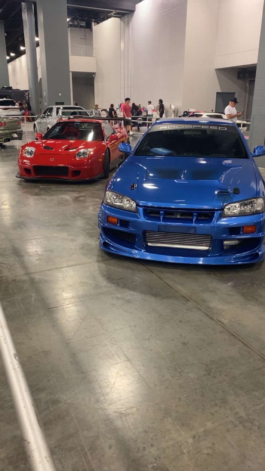
A journalist provided a challenging image: a decade-old photo of a car show with no metadata, no obvious landmarks, and significant visual noise. The objective was to confirm the probable location and event title using only visual evidence verification.

Signal vs noise

Traditional geo-estimation methods rely heavily on distinct landmarks or embedded GPS data. In high-density event photography, these signals are often obscured by crowds, temporary structures, and vehicles.

Oceanir's Orca model utilizes a multi-layered analysis approach to separate transient "noise" (people, cars, banners) from immutable environmental signals (structural steel, flooring, HVAC ducting).

Analysis timeline

Time
Action
T+05s
System isolates vehicle clusters from structural background. Foreground density (crowds) successfully masked.
T+15s
Structural analysis identifies unique ceiling truss pattern and HVAC ducting consistent with Miami Beach Convention Center.
T+25s
Lighting grid geometry and polished concrete floor reflectivity match Hall C reference fingerprints with 99.1% confidence.
T+30s
Venue confirmed: Miami Beach Convention Center, Hall C. Event correlation: Miami International Auto Show.

"It was the perfect edge case: high visual noise obscuring the actual location signals. Oceanir solved it in under a minute."

Automated forensics

The ability to rapidly geolocate images with high signal-to-noise ratios is critical for verifying open-source investigation. This demonstration proves that automated systems can now perform forensic-level analysis in seconds that previously required human experts hours to complete.

Try it yourself

Access the same forensic capabilities used in this case study.

Launch Demo
Related posts

View all
Introducing Desktop, the world's first visual intelligence workspace
product

Introducing Desktop, the world's first visual intelligence workspace

The value was never just the prediction. It is the workflow around the prediction. Oceanir Desktop is where that workflow finally has a home.

The Complete Image Geolocation Workflow: From Metadata to Map Verification
product

The Complete Image Geolocation Workflow: From Metadata to Map Verification

The full chain analysts run to geolocate an image: EXIF check, visual anchors, reverse image search, AI estimation, and map verification, ending in a documented confidence trail.

Orca, to your favorite cities.
product

Orca, to your favorite cities.

102-city coverage, more city-native reads, and sharper confidence in the places people actually asked us for.

01platform
  • Pricing
  • Geoestimation
  • How It Works
02resources
  • Blog
  • Documentation
  • Contact
03company
  • About Us
  • Security
04legal
  • Terms
  • Privacy
  • DPA
  • Product Boundaries
  • SaaS Agreement
  • Cookies

Notes from the verification desk. What we're learning about reading places from pixels. Occasional, no noise.

Try it on one image

Upload a photo. Watch it come back as a place.

Run a free analysis →Talk to us →
oceanir
© 2026 Oceanir, LLC. All rights reserved.
PrivacyTerms