Oceanir
  • Pricing
SalesStart free
Blog/Product
Product

Introducing Orca 1

City-scale visual evidence verification. Bringing structure to the chaotic visual grammar of urban environments.

Oceanir Team·Dec 8, 2025·8 min read
XGitHub
Introducing Orca 1

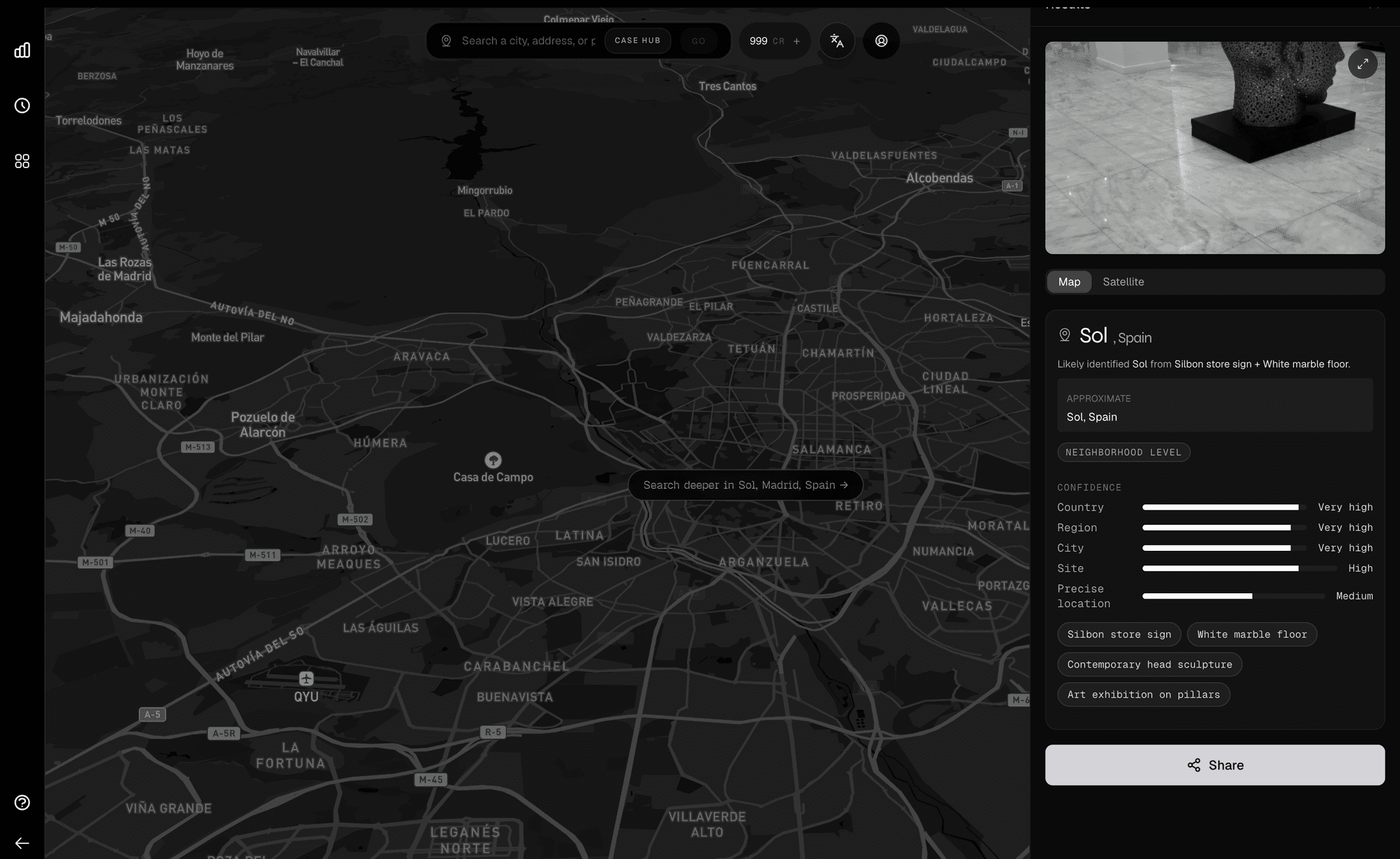
Generic image classifiers often fail to capture the nuanced visual grammar of specific urban environments. They see "buildings" and "roads" but miss the context. Orca 1 is different. It brings semantic understanding to raw pixels.

Designed for reality

Orca 1 is trained on city-specific datasets to distinguish neighborhoods based on architectural patterns, vegetation density, infrastructure style, and signage typography.

"Orca answers not just 'where is this', but 'what is the function of this space'. It bridges the gap between satellite imagery and street-level reality."

Performance benchmark

Compared with a reference baseline, Orca 1.1 achieves superior semantic density through specialized training on privacy-compliant urban datasets.

Model
Semantic Score
Standard ResNet
58.0
Reference baseline
74.0
Orca 1.1
96.5

Core features

Orca 1 introduces six core capabilities designed for urban-scale visual evidence verification.

  • Pattern recognition — Identifies architectural styles, vegetation patterns, and urban infrastructure unique to specific neighborhoods.
  • Text extraction — High-fidelity OCR to read signage, storefronts, and street names even in low-resolution imagery.
  • Solar analysis — Infers time-of-day and cardinal direction from solar positioning cues and shadow angles.
  • Cross-reference — Validates visual data against a proprietary index of millions of geo-tagged reference images.
  • Privacy core — Processes imagery without facial recognition or PII retention. Built with compliance by design.
  • Real-time stream — Optimized for high-throughput streams, enabling live analysis of video feeds with minimal overhead.

Deploy Orca 1

Launch the interface to start processing imagery.
Launch InterfaceView Pricing

Related posts

View all
Introducing Desktop, the world's first visual intelligence workspace
product

Introducing Desktop, the world's first visual intelligence workspace

The value was never just the prediction. It is the workflow around the prediction. Oceanir Desktop is where that workflow finally has a home.

The Complete Image Geolocation Workflow: From Metadata to Map Verification
product

The Complete Image Geolocation Workflow: From Metadata to Map Verification

The full chain analysts run to geolocate an image: EXIF check, visual anchors, reverse image search, AI estimation, and map verification, ending in a documented confidence trail.

Orca, to your favorite cities.
product

Orca, to your favorite cities.

102-city coverage, more city-native reads, and sharper confidence in the places people actually asked us for.

01platform
  • Pricing
  • Geoestimation
  • How It Works
02resources
  • Blog
  • Documentation
  • Contact
03company
  • About Us
  • Security
04legal
  • Terms
  • Privacy
  • DPA
  • Product Boundaries
  • SaaS Agreement
  • Cookies

Notes from the verification desk. What we're learning about reading places from pixels. Occasional, no noise.

Try it on one image

Upload a photo. Watch it come back as a place.

Run a free analysis →Talk to us →
oceanir
© 2026 Oceanir, LLC. All rights reserved.
PrivacyTerms