Update 1.40 is focused on our newest product updates. We expanded solution coverage across core industries, rebuilt solution pages to clearly map workflows and outcomes, and improved documentation so teams can go from evaluation to integration faster.
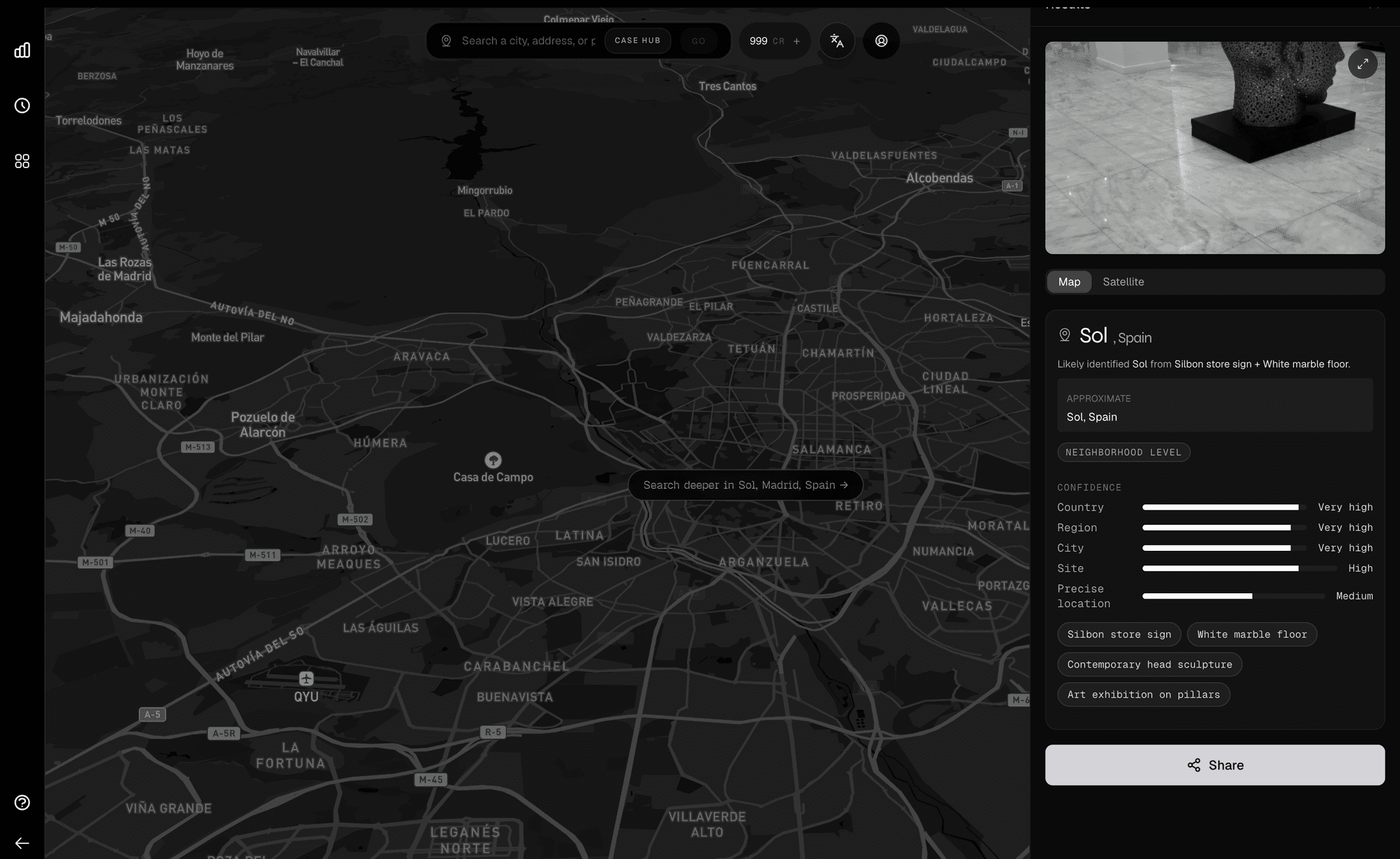
We've cut down on the cities. We like the addition of multiple cities, but we noticed they lacked accuracy, so Miami is our start. Orca 1.4 is our push, and we're actively improving Orca 1.4 to fill in the gaps and compete globally.
What changed
This release is centered on product clarity, stronger focus, and practical adoption across real customer workflows.
- Expanded solutions: Added and refined vertical solution coverage for journalism, law, security, insurance, and real estate.
- Proper solution structure: Each solution now has clearer workflows, stronger proof points, and focused messaging for real operational use.
- Docs improvements: Documentation has been reorganized and expanded so setup paths, capabilities, and integration steps are easier to follow.
- Navigation cleanup: We removed outdated navigation paths that no longer matched the active product and focused the site on core product routes.
- New homepage loading: The homepage now has a brand new loading sequence with layered transitions that make the first experience feel more intentional.
- Brand new animations: We shipped a lot of new animations across key sections, including smoother motion in hero content, cards, and interaction states.
Custom pricing and a custom model are available via contact for enterprise industry solutions.
Industry solutions
Orca 1.3 vs Orca 1.4
Orca 1.4 averages 3s per analysis. Here is what is different.
What to expect in 2026
2026 is about building on the foundation laid in this update. Each quarter will bring meaningful improvements to both the analysis engine and the surfaces around it.
- Q1 — Stabilizing the new design system and shipping Orca 1.4 improvements.
- Q2 — Expanding city coverage and introducing team collaboration features.
- Q3 — Batch analysis and improved satellite imagery support.
- Q4 — API access for enterprise users and advanced privacy controls.
Changelog
- New Unit workspace
- Onboarding wizard after purchases
- Redesigned interface across the platform
- Settings rebuilt from scratch
- Renamed geolocation to geo-estimation
- Updated footer and navigation
- Improved error handling across API
- Security hardening on redirects
Experience the redesign
Explore the new interface across Settings, Unit, and the analysis workflow.
Launch Demo →