AI photo geolocation tools all promise the same thing: upload a photo, get a place. The differences that matter are the ones the marketing leaves out. Who is allowed to use it. What it returns when it is unsure. Whether you can see why it chose a place. What happens to your upload. This comparison covers four tools and, more usefully, how to test any of them yourself.
The short version
The tools differ most on access, on whether you can see why they chose a place, and on what they say when they are unsure. Accuracy numbers are vendor-reported and rarely comparable. Test every tool on ten photos you know, and score whether it admitted doubt as well as whether it was right.
01
The four tools at a glance
| Oceanir | Picarta | GeoSeer | Raven (formerly GeoSpy) | |
|---|---|---|---|---|
| Who can use it | Anyone with a free account. Paid plans add street-level checks and saved evidence. | Anyone on its website. Free plan: 1 search. $15.90 one-time for 20 searches, or $59.90 a month for 100. | Anyone. Free plan: 1 web search a day and 10 API calls in total. Paid plans from $9 a month billed annually ($19 monthly). | Verified agencies and investigative teams, by demo request. The public GeoSpy ended. |
| What it returns | A suggested place on a map with a confidence level and the clues behind it. Deeper checks add ranked candidates. | City, country and GPS with a confidence score, plus 10 possible locations on a map. | Location results from images, video and event descriptions, using Fast, Agent and Event modes. | Ranked geographic leads, street-level candidates and a case workspace. |
| Beyond finding a place | Nothing. Places only, never people. | Nothing. Location only. | Image sets, video and event descriptions. | Vehicle identification, image-manipulation signals, and public account lookups from an email address or phone number. |
| API | Available for reviewed integrations. | Enterprise accounts only, per its pricing page. | On every plan: 10 calls free in total, then 100 or 1,000 a month on paid plans. | Not public. |
| Accuracy claims | We publish benchmark results on our blog. Test it on your own photos as well. | 44.8% within 1 km on IM2GPS3k. It says the comparison with other methods may not be entirely fair. | 94% within 1 km on a 62-image set it built, snapshot October 14, 2026. | None we could find. |
| Stated limits | Not guaranteed to be exact. A photo with few cues stays at area level. Never identifies people. | Recommends checking all 10 results when confidence is low. | Says Fast and Agent modes work best on clear landscapes and readable text. | Verified agencies only, so you cannot try it without a demo. |
Read from each vendor's own public pages on 5 November 2026. This describes access and output, not quality. Quality is something you measure.
Two cautions. First, the table does not rank the tools. Quality is measured on your photos, not read off a page. Second, Raven is here because people searching for GeoSpy often land on pages like this one. It is not a tool you can try today unless you are a qualified buyer.
02
Why a headline accuracy number tells you little
Every vendor quotes accuracy somewhere. Read the footnote before you read the number.
- Which dataset? A benchmark of famous landmarks is far easier than one of ordinary streets. A vendor's own dataset is the easiest to do well on.
- Which threshold? Within 1 km, 25 km and 750 km are different claims. A tool can be excellent at country level and poor at street level.
- Which photos? Benchmark photos can sit in the training data of someone's system. Your own photos do not.
- Who measured it? A number measured by the vendor is a claim. A number reproduced by someone else is evidence.
Here is a concrete case. GeoSeer's page reports 94% for itself and 79% for Oceanir on a 62-image set that it built, covering urban, rural and indoor scenes. Picarta's page reports 44.8% on a public benchmark and says the comparison with other methods may not be entirely fair. Those are three different sets, thresholds and scenes. We have not reproduced the GeoSeer figures, and our own benchmark results are on our blog.
None of this means the numbers are wrong. It means two numbers from two vendors are rarely comparable. Your own test is the only comparison that is.
03
A test you can run in an afternoon
You need ten photos whose location you know for certain. Take them yourself, or use ones from a trusted source with confirmed locations. Mix the difficulty.
- Pick three easy photos. A famous landmark, or a street with readable signs.
- Pick four medium photos. Ordinary streets, a distinctive building, a rural road with a few cues.
- Pick three hard photos. A generic suburb, an almost empty landscape, a heavily cropped frame.
- Run every photo through every tool you are considering, without hints.
- Score each result three ways. How far was the best answer from the truth? Was the true place anywhere in the ranked list? Did the tool say it was unsure when it should have?
- Read the reasoning. For the ones it got right, did it get there for the right reasons? For the ones it got wrong, could you tell from the output that it was wrong?
What counts as easy, medium or hard is about the cues in the frame, not about any tool. These three published photos show the range. The grouping is our judgment, not a measured result.
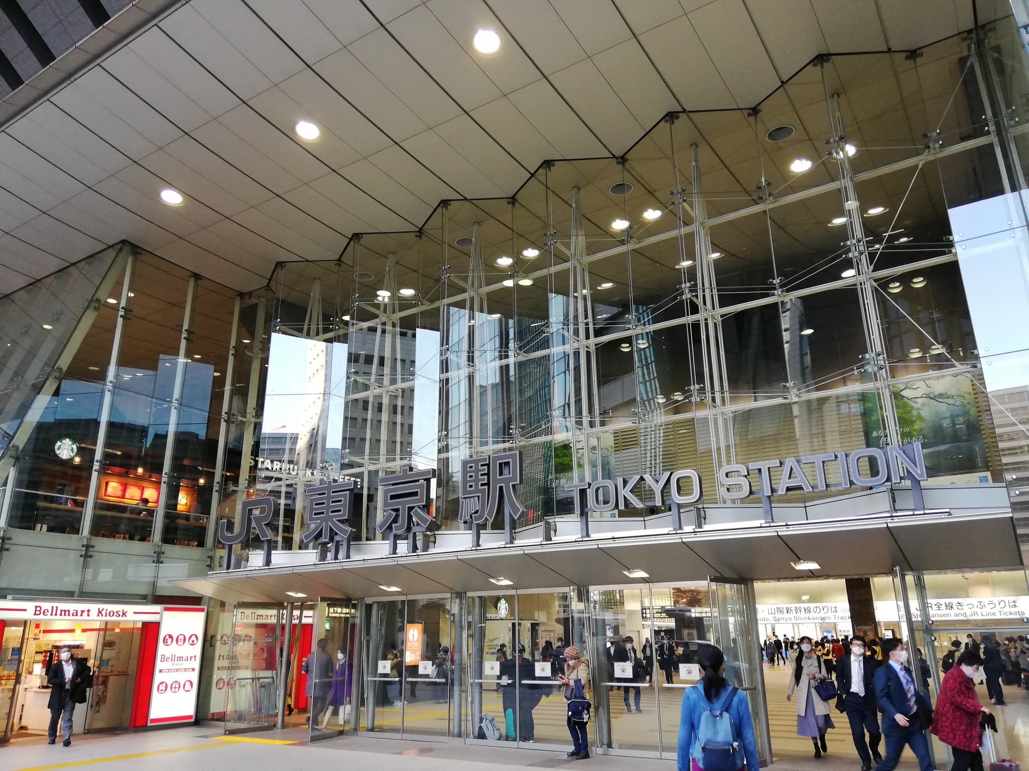
Strong cues
The place is named in two scripts, and the gates and facade point to one side of the station.
Photo: 先従隗始 · CC0 1.0 · Wikimedia Commons · 2021-11-26
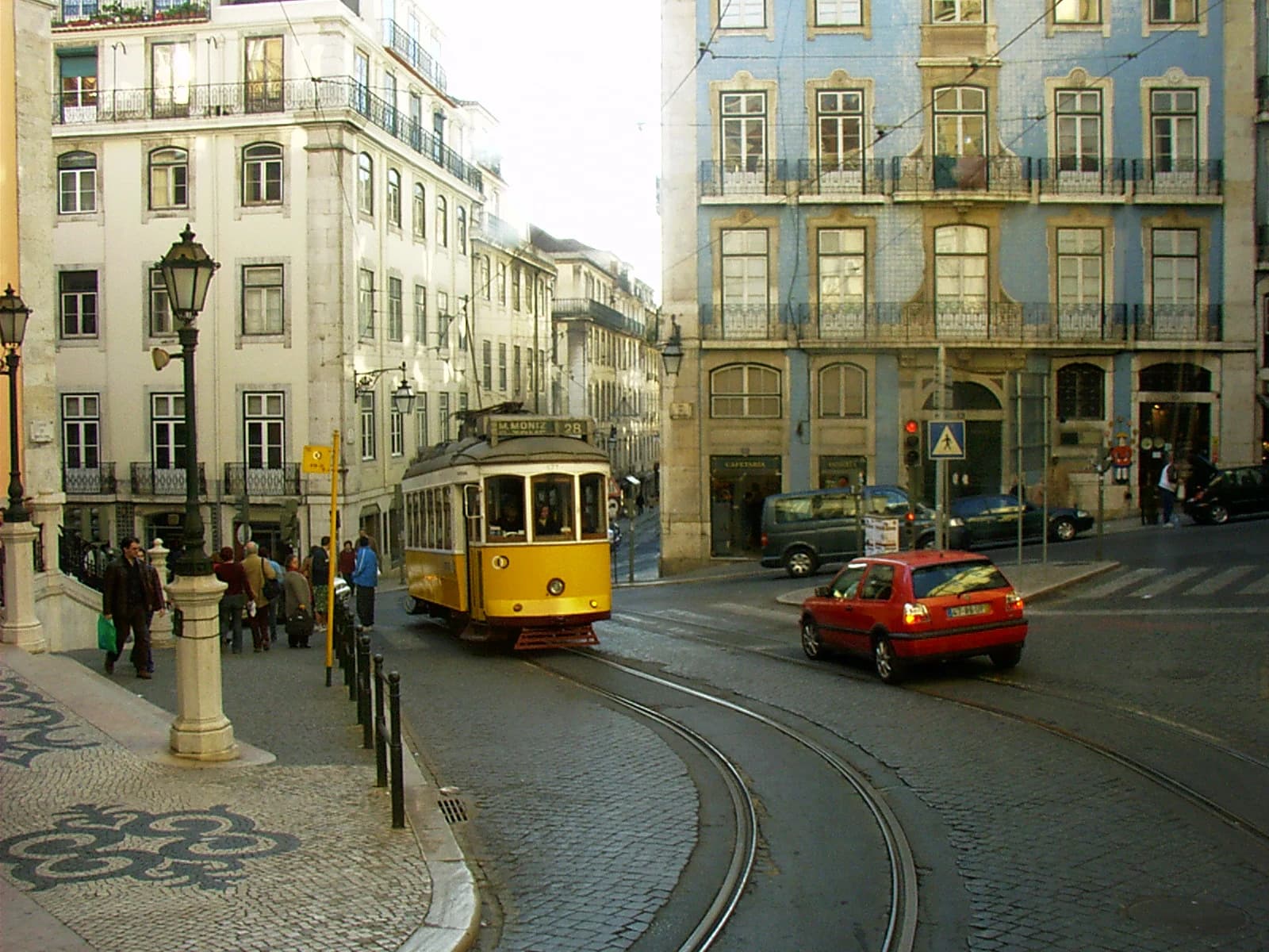
Some cues
No place name. The rail curve, the corner building and the paving give geometry to match on a map.
Photo: Mdiagom · CC BY-SA 3.0 · Wikimedia Commons · Converted to WebP; no crop.
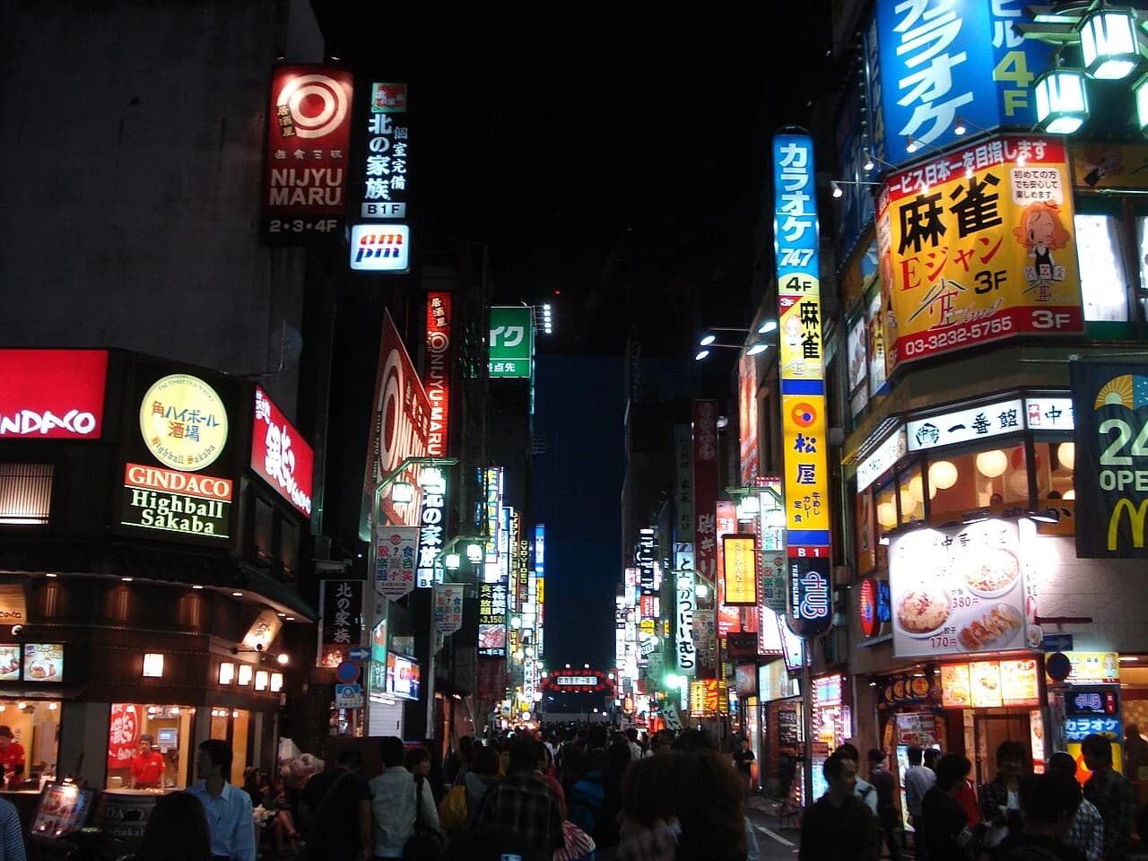
Few precise cues
Script and signs say Japan. They do not say which district, and the photo is from 2009.
Photo: Carles Tomás Martí · CC BY 2.0 · Wikimedia Commons · Resized and converted to WebP; no crop.
photo,difficulty,true_location,answer_given,distance_km,true_place_in_ranked_list,said_it_was_unsure
1,easy,,,,,
2,easy,,,,,
3,easy,,,,,
4,medium,,,,,
5,medium,,,,,
6,medium,,,,,
7,medium,,,,,
8,hard,,,,,
9,hard,,,,,
10,hard,,,,,
The third score matters most in investigations. A tool that is right six times in ten and says when it is unsure is more useful than one that is right seven times in ten and always sounds certain.
04
Questions to ask any tool
- Can I see why it chose that place? An answer you cannot inspect cannot go in a report.
- What does it do when the photo has few cues? It should say so, not invent a pin.
- What happens to my upload? Check retention, whether you can delete it, and whether you can switch saving off.
- What will it refuse to do? A responsible tool states its limits, such as not identifying people.
- Can I export the result? If it ends up in a case file, you need more than a screenshot.
- Who can use it, today? A tool you cannot get access to is not an option.
05
Red flags
- A single pin with no reasoning. You cannot check it.
- Always certain. A tool that never says it is unsure will be wrong with confidence.
- Exact addresses from any photo. Few photos support that. Treat the claim as marketing until your own test says otherwise.
- Nothing about what happens to uploads. If retention is not stated, assume the worst.
- Marketing about finding people. A tool sold for tracking individuals is not a tool for verifying places, and it carries risk for whoever uses it.
- A site that borrows a famous name. Graylark says third-party sites and apps using the GeoSpy name are not operated by or affiliated with it. Check who runs a site before you upload anything.
06
Which one for whom
| If you are | Look for | Because |
|---|---|---|
| A journalist or fact-checker | Open access, visible reasoning and an exportable record | You need to show an editor how you got there. |
| An independent investigator | Open access, saved history you can switch off, and honest limits | You handle sensitive material and keep your own notes. |
| A claims or compliance team | An export, a record per image and clear retention terms | The result goes into a file someone else reviews. |
| A developer | A documented API, rate limits and error behaviour you can test | You are building on it. |
| A government or law-enforcement buyer | Contract terms, support, and a clear statement of what the tool will not do | Access and accountability matter as much as accuracy. |
07
Where Oceanir fits, and where it does not
Oceanir is built for people who have to defend an answer: journalists, investigators and claims teams. It returns a suggested place with the clues behind it, keeps ranked candidates you can compare, and lets you export what you found. You can run a free scan with a free account, turn saved history off, and use deeper checks when a photo matters.
Its limits are real. It does not guarantee an exact location, and a photo with few cues stays at city or area level. It will not tell you who is in a photo. When you need to be sure, the confirmation still happens on a map, by you.
08
Questions
What is the best AI photo geolocation tool?
It depends on who you are and what you need to defend. For open access and visible reasoning, look at tools anyone can use and test them on photos you know. For agency work, access terms decide. No vendor's accuracy number replaces your own test.
Is GeoSpy still available?
Not as a public tool. Graylark, the company behind it, says GeoSpy is now Raven, and Raven is available to verified agencies and investigative teams. Its founder wrote that the free public platform was shut down in the first quarter of 2025. Third-party sites using the GeoSpy name are not operated by Graylark, so check who runs a site before you upload. The GeoSpy alternative page covers what to use instead.
Are these tools accurate enough for evidence?
An AI estimate is a lead, not evidence. Use it to decide where to look, then confirm against imagery you can cite and write down how you did it.