Lists of OSINT tools are easy to find and hard to use. They sort by brand, so you cannot tell which tool solves the problem in front of you. This guide sorts by job. Pick the step you are stuck on and read that section.
Nothing here is complete, and tools change, close and move behind paywalls. Treat the names as starting points and check the current state of any tool before a case depends on it.
The short version
Hash and archive first. Run two reverse image engines. Confirm on satellite and street-level imagery from more than one source. Use feature search to turn a vague scene into a list. Use sun and shadow tools to test a candidate, never to find one. Use an AI estimate to start, not to finish.
01
Start here: what do you have?
| If you have | Reach for | Then |
|---|---|---|
| The original file | A hash utility and ExifTool | Record the hash before you do anything else. |
| A screenshot of a post | A web archive | Save the post, then look for the original upload. |
| Readable text | A search engine and a map search | Search the text in its own script. |
| A building or landmark | Reverse image engines, then a satellite view | Compare rooflines and outlines. |
| A road with markings | Street-level imagery in the candidate countries | Compare markings, kerbs and poles. |
| A mountain or ridge line | PeakFinder | Confirm on satellite imagery. |
| A combination of features | OpenStreetMap feature search | Check each result on street-level imagery. |
| Nothing obvious | An AI estimate | Test the top candidates, not only the first. |
02
Preserve and document
Do this before anything else. The goal is to be able to show later what you were given and what you did with it.
- A hashing command or utility. A SHA-256 hash of the file shows it has not changed. Every major operating system can produce one without extra software.
- Web archives. The Internet Archive's Wayback Machine and similar services save a page as it was. Save the post you found the image on before it disappears.
- Screenshots with the address bar and time visible. Crude, but it is what an editor asks for.
- A notes file per image. A shared document works. The structure matters more than the product.
03
Check metadata
- ExifTool. The standard command-line reader for metadata in images and many other file types. It shows what a file carries, and what it does not.
- The file info built into your phone or computer. Fine for a quick look.
Expect little. Most platforms remove location tags, and any tag that remains can be edited. A tag that survives is a lead, and you still confirm it from the scene.
04
Reverse image search
Run several, because their indexes differ: Google Lens, Yandex Images, TinEye and Bing Visual Search. The OSINT image search guide covers how to use them well, how to read results and when to stop.
05
Maps, satellite and street-level imagery
| Tool | Use it for | Watch out for |
|---|---|---|
| Google Earth Pro | Satellite imagery with a historical slider, measuring distances and drawing overlays. | Capture dates vary by area. Check the date of each view. |
| Google Maps and Street View | Street-level comparison in most countries. | Coverage is patchy in some regions, and imagery can be years old. |
| Bing Maps | A second satellite source, sometimes sharper or newer for an area. | Different capture dates from other sources help or mislead. Check each. |
| Yandex Maps | Street-level panoramas, strongest in Russia and some neighbouring countries, where other services are thin. | Check coverage for your area before you rely on it. |
| Mapillary | Community-contributed street-level images, useful where major services have nothing. | Quality and coverage depend on who uploaded. |
| OpenStreetMap | Searching the world by feature: roads, buildings, land use and named places. | The data is volunteer-made, so completeness varies by area. |
06
Search the map by feature
This is the most underused technique. If your image shows a roundabout beside a river with a rail line, you do not have to browse. Tools that query OpenStreetMap data, such as Overpass Turbo, let you search an area for combinations of features. You describe the pattern, the tool returns every place that matches, and you check the shortlist by eye. It turns a vague scene into a finite list.
[out:json][timeout:60];
way["railway"="rail"]({{bbox}})->.rail;
way["junction"="roundabout"](around.rail:100)({{bbox}});
out center;
Zoom the map to the area you want to search first, because the bbox shortcut uses the current view. Change the tags to match your scene and the radius to match your image. The OpenStreetMap wiki lists the tags for most features. Treat every result as a candidate to check, not an answer.
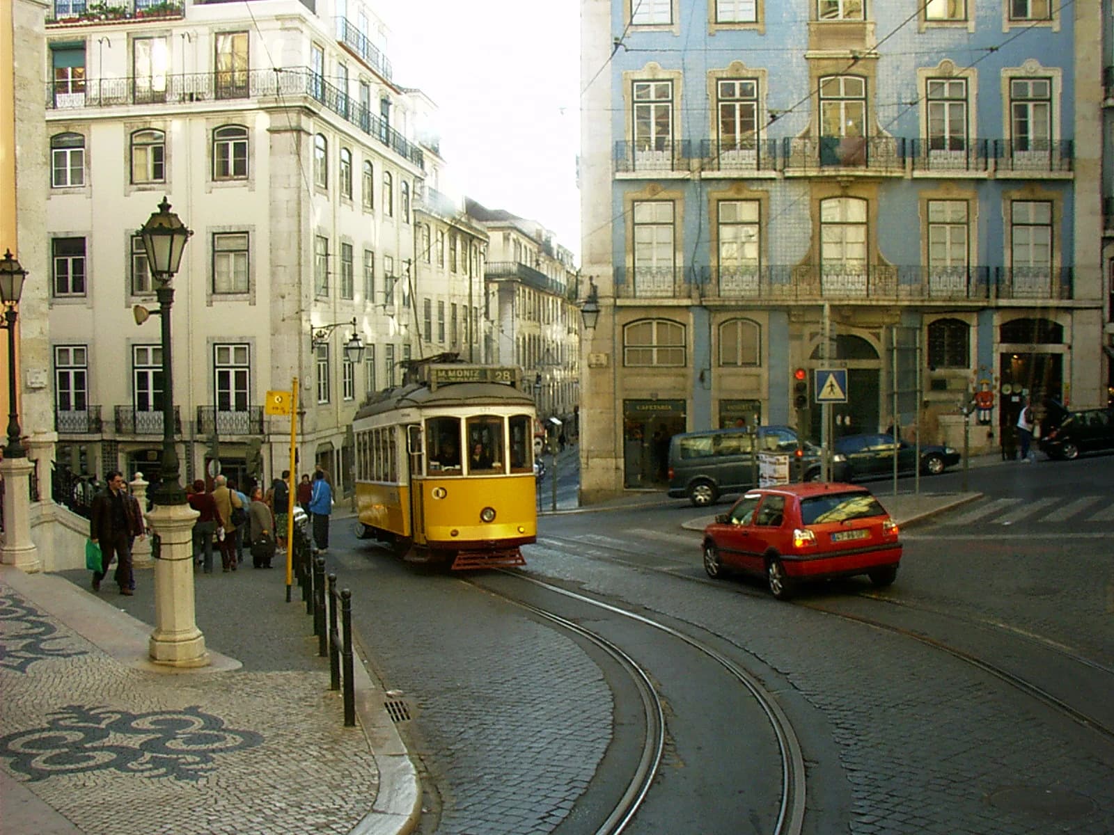
Photo: Mdiagom · CC BY-SA 3.0 · Wikimedia Commons · Converted to WebP; no crop.
Fixed geometry is searchable. The curve of the rails and the side street meeting the corner building are the kind of features a map query can look for. The tram, the signs and the people are not.
07
Sun, shadows and terrain
- SunCalc. Shows the sun's direction and shadow lengths for any place and time. Use it to test a candidate place and date, not to find one.
- PeakFinder. Labels mountain skylines from a chosen viewpoint. Useful when the only fixed feature is a ridge line.
- Sun and shadow tools in general. They need a known object height, level ground and a trustworthy date before they say anything useful.
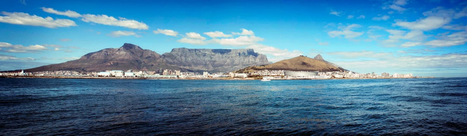
Photo: Darryn van der Walt · CC BY-SA 3.0 · Wikimedia Commons · Resized and converted to WebP; no crop.
A ridge line is a fixed feature. Keep the whole skyline in the frame, because one cropped peak says far less than the arrangement of several. This is the kind of scene a ridge-matching tool can test, and a map can confirm.
08
AI estimation
AI estimation reads the scene and ranks places, so you start with a shortlist instead of an empty map. Several tools do this, and they differ in who can use them, what they return and how they handle uncertainty. The comparison of AI geolocation tools covers how to test one before you trust it.
Oceanir's free scan gives a suggested place with a confidence level and the clues behind it. Deeper checks add ranked candidates and street-level comparison, and saved results can be exported for your notes. It answers where an image was taken, never who is in it.
09
Where the tools mislead you
- Imagery dates. Every map service mixes capture dates. Always note the date of the view you used.
- Blurring and gaps. Some areas are blurred, removed or never captured.
- Different angles. Satellite views look straight down and photos do not. Compare outlines and layout, not perspective.
- One source. If a single service is your only confirmation, check a second.
- Changed places. Buildings are demolished and roads are rebuilt. A mismatch can mean the scene changed, not that the candidate is wrong. Check historical imagery before you reject one.
10
Putting a toolkit together
You do not need all of this. A sensible minimum for most work:
- A hash utility and a web archive, for preserving.
- Two reverse image engines.
- One satellite source with historical imagery, and one street-level source.
- OpenStreetMap with a feature-search tool.
- A sun position tool.
- An AI estimate for triage and shortlisting.
Add the specialist tools when a case needs them.
11
Questions
What is the best OSINT tool for geolocation?
There is not one. Each tool does a job: preserve, search, map, confirm. The best choice is the one that fits the step you are on, and most investigations use four or five together.
Are there free tools for OSINT geolocation?
Most of the tools above are free or offer a free version, including ExifTool, SunCalc, OpenStreetMap, Google Earth Pro and the major reverse image engines. Check current terms before a case depends on them.
Can AI replace these tools?
No. AI estimation speeds up the earliest steps, but confirmation still comes from maps and imagery you can cite.